
WSPRNet Data Used to Validate SAMI3 Published in Space Weather Journal
WSPRNet Data Used to Validate SAMI3 Published in Space Weather Journal
Saturday, December 23, 2023 - 11:26
Thursday, December 21, 2023 - 11:09
Submitted 2 years 3 months ago by af8a.
A team of scientists led by Alex Chartier at Johns Hopkins Applied Physics Laboratory just published a study Validating Ionospheric Models Against Technologically Relevant Metrics, published in the peer-reviewed American Geophysical Union journal Space Weather. Co-authors include Josh Steele, G. Sugar, David Themens, Sarah Vines, and Joseph Huba.
The paper describes how novel, open access tools were used to validate Sami is Another Model of the Ionosphere (SAMI3) in terms of the following metrics:
-
Errors on GPS 3D position
-
HF ham radio communications via WSPR Signals
-
Peak F-region density (with machine learning algorithms used to "clean" the data used in this analysis)
Excerpted from the paper:
...The ability of the ionosphere to reflect radio signals back down to Earth is the central property that led to its discovery. Several important technological applications make use of this property, notably geolocation, skywave over-the-horizon radar and long-distance communications. In recent years, radio amateurs (or “hams”) have begun probing HF propagation paths (e.g., Frissell et al. 2014) using the WSPR protocol designed by Joseph Taylor, a nobel laureate and ham. A substantial database of radio links has been established, that we have used to test propagation paths in ionospheric models...
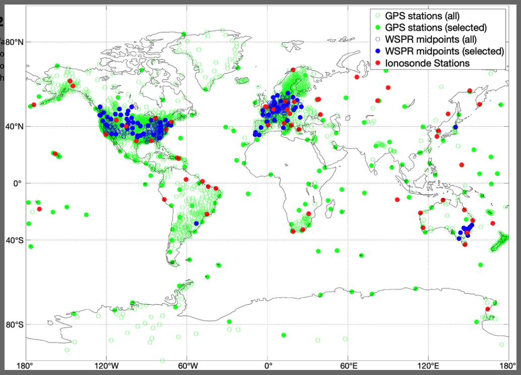
This map shows spatial GPS, Weak Signal Propagation Reporter (WSPR) and ionosonde data used in the study. Open circles indicate datapoints discarded for computational efficiency, while filled circles were used in the analysis. WSPR midpoints are shown for one representative time interval (0000–0100 UTC on 15 March 2019)
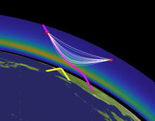
The lead image shows a 3D homing algorithm, developed by the authors, using the PHaRLAP engine. Shown are ground-to-ground (yellow), ground-to-space (magenta), and space-to-space (white) point-to-point raytracing. Satellites indicated in red.
The authors note that the underlying data sources and software are publicly available, so that interested groups may apply these tests to other models and time intervals.
Congratulation, all!